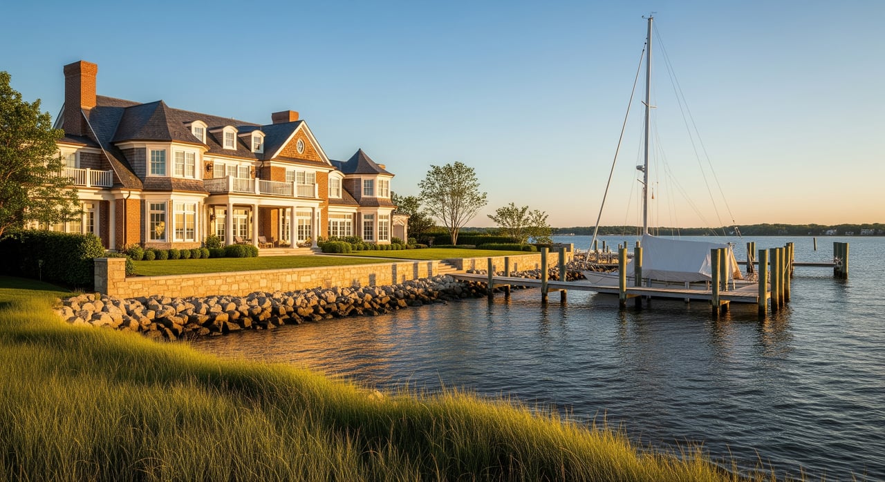
Water at your doorstep is a dream. The rules beneath it can be confusing. If you are considering a waterfront home in Annapolis or greater Anne Arundel County, understanding riparian rights will help you buy with confidence. In this guide, you will learn what those rights mean in Maryland, how local rules shape docks and shoreline use, and the due diligence steps that protect your investment. Let’s dive in.
Riparian rights in Maryland, simplified
When a property touches tidal water in Maryland, it may carry riparian rights. These are property rights connected to access and reasonable use of the water. In practice, that can include building a pier, mooring boats, and benefiting from gradual shoreline changes, all subject to regulation. The key is whether the specific parcel is an upland lot that actually adjoins tidal water and carries those rights in its deed.
On tidal waters, your land typically extends to the mean high‑water (MHW) line. That is the average high tide mark. The state generally holds the submerged lands below MHW for the public’s benefit. This is part of Maryland’s Public Trust Doctrine, which protects navigation, fishing, and other public uses.
Riparian rights are strong but not absolute. They can be limited by state and federal laws, county codes, conservation programs like the Critical Area, and private covenants or easements. If a right would harm public navigation or sensitive habitat, it can be restricted. Always verify what the deed conveys and what regulations apply on site.
What shapes your use in Annapolis
Waterfront improvements around Annapolis are regulated by several agencies working together. At the federal level, the U.S. Army Corps of Engineers (USACE) oversees structures in navigable waters and any dredging or fill. The Maryland Department of the Environment (MDE) handles tidal wetlands and waterway permits at the state level. The Maryland Department of Natural Resources (DNR) manages aquatic resources, including submerged aquatic vegetation and shellfish areas that can affect pier siting, moorings, and dredging.
Maryland’s Critical Area program protects land within 1,000 feet of tidal waters. This program adds rules for buffers, vegetation, and impervious surfaces, and it influences where and how you can place a pier or stabilize a shoreline. Anne Arundel County applies zoning, building, and floodplain rules, and some neighborhoods add HOA covenants, pier committees, or shared-dock requirements.
You should expect design limits on pier length and width, limits to protect navigation and habitat, and location restrictions near submerged grasses or shellfish sanctuaries. Dredging, if needed for boat access, is reviewed closely and is sometimes not allowed. Each property is unique, so the mix of approvals and the timeline can vary.
What to verify before you buy
Documents to request
- Full deed and any easements, riparian grants, or covenants tied to shoreline use or dock rights.
- Survey or plat showing the mean high‑water line and lot dimensions.
- Title report with any pier licenses or recorded agreements.
- Existing pier, dock, or lift permits and any as‑built or compliance records.
- Records of any dredging permits and disposal agreements.
- HOA or community documents for shared docks or moorings.
- Shoreline stabilization records and permits for bulkheads or living shorelines.
- Any submerged land or shellfish lease records that may affect use.
- FEMA flood map information and any history of flooding or erosion.
On‑site checks to complete
- Confirm the tidal boundary on a current survey and whether the deed conveys riparian rights.
- Inspect the dock’s condition, materials, and whether it is fixed or floating; note lifts and piling condition.
- Check water depth at mean low water where you plan to berth a boat; assess whether dredging would be required.
- Look for signs of submerged aquatic vegetation or shellfish bars that may affect permits.
- Evaluate bulkheads, erosion, and vegetation within the Critical Area buffer.
Questions to ask early
- Are riparian rights or a pier easement specifically recorded?
- What permits exist for any current pier, and are they transferable?
- Have there been violations, complaints, or enforcement actions at the shoreline?
- Do neighbors have docks that may encroach? Are there access disputes?
- Has the owner sought approvals for maintenance, replacement, or dredging before?
Building or replacing a pier
Permits and timing
Most private piers on tidal waters need federal, state, and county approvals. USACE reviews structures and any dredging. MDE processes tidal wetlands and waterways approvals. Anne Arundel County applies local codes and floodplain rules, and HOA approvals may also be required. Typical reviews take weeks to months, and complex sites can take longer, especially where dredging or mitigation is involved.
Design and location limits
Pier length, width, pile spacing, and platform size are often limited to protect navigation and aquatic habitat. Piers are frequently prohibited in mapped submerged aquatic vegetation beds or certain shellfish sanctuaries. Where piers are allowed, design tweaks like narrow footprints or seasonal construction windows may be required to reduce impacts.
Dredging realities
Dredging for boat access triggers both federal and state reviews and may require mitigation. Sites near submerged grasses, shellfish beds, or cultural resources face higher scrutiny. In some locations, dredging is not feasible. If dredging is allowed, plan for additional time, cost, and ongoing maintenance over the years.
Shoreline stabilization options
Shoreline protection is also regulated. Depending on site conditions, you may see older bulkheads, rock revetments, or living shorelines that use grading, plants, and stone sills. Where feasible, living shorelines are encouraged because they reduce erosion and support habitat. Replacement of older hard structures is often possible, but design and mitigation can apply inside the Critical Area.
If you plan to upgrade a shoreline, involve a marine contractor early. The team can assess wave exposure, fetch, and soil conditions, then advise on a design that balances durability, permitting, and cost.
Title and boundary nuances
Riparian ownership is tied to the upland parcel and the MHW line. In general, gradual shoreline change, called accretion or reliction, can shift the boundary. Sudden events, known as avulsion, may not. Deed language and local law guide these outcomes, so it is wise to have a surveyor mark the current boundary and a real estate attorney review the title.
Be alert to easements and community arrangements. Some neighborhoods offer community piers with assigned slips or moorings. Others prohibit private docks or require shared facilities. A parcel can be waterfront yet lack riparian rights, or it can rely on an easement across a neighbor’s land to reach a dock. Document these details before you write your offer.
Risk and resilience on the Bay
Annapolis and the Chesapeake region experience relative sea‑level rise and increased tidal flooding. When evaluating a property, consider finished floor elevations, placement of mechanicals, and how a pier or bulkhead will perform over time. Insurance, flood maps, and realistic maintenance planning should be part of your financial model.
Resilience does not just mean height. Native plantings, thoughtful drainage, and appropriate shoreline treatments reduce long‑term risk. A well‑designed living shoreline or well‑maintained bulkhead can protect the site and make future approvals smoother.
Smart contract contingencies
Protect your interests by building due diligence into your offer. Consider contingencies for:
- A current boundary and MHW survey and review of any encroachments.
- Confirmation of riparian rights or pier easements in the recorded title.
- Review of existing pier permits and a feasibility assessment for your intended use.
- Environmental screening for submerged grasses or shellfish areas near the site.
- County zoning, floodplain, and Critical Area compliance review.
Who to have on your team
- Real estate attorney with waterfront experience to review deed, easements, and title exceptions.
- Licensed surveyor with tidal boundary expertise to locate the MHW line and any encroachments.
- Marine contractor to assess pier condition, design options, and probable costs.
- Permitting or environmental consultant to map constraints like submerged grasses and shellfish areas and to coordinate permits.
- Anne Arundel County permit staff and state agency contacts to clarify local requirements and timelines.
Bringing it all together
Buying waterfront in Annapolis is about more than views. It is about aligning your goals with your deeded rights, local rules, and the site’s natural conditions. When you check the title, confirm the boundary, and understand the permitting pathway, you can plan the pier, boat access, and shoreline your lifestyle requires. If you want a seasoned partner to coordinate the process and keep your purchase on track, connect with Jeff Lockard for tailored guidance.
FAQs
What are Maryland riparian rights for tidal waterfront buyers?
- They are property rights tied to upland parcels that touch tidal waters, generally including reasonable water access and potential to build a pier, subject to regulation and public trust limits.
Do Annapolis waterfront homes always include pier rights?
- No. Deeds, plats, covenants, and easements control whether a parcel has riparian rights, a private pier, a shared pier, or only visual access.
Who controls the land under the water in Anne Arundel?
- The state generally holds submerged lands below the mean high‑water line for public uses like navigation and fishing under the Public Trust Doctrine.
Can I place a dock anywhere along my shoreline?
- No. Pier location and design must meet federal, state, and county rules, and areas with submerged grasses or shellfish sanctuaries are often off‑limits.
What is the Critical Area and why does it matter?
- It is the 1,000‑foot strip along tidal waters where added protections apply to buffers, vegetation, and impervious surfaces, affecting piers and shoreline work.
Is dredging for deeper boat access usually allowed?
- It depends. Dredging is tightly regulated and may be difficult or impossible near sensitive habitats; where allowed, it requires permits and can add time and cost.
How do shoreline changes affect my property line?
- Gradual change can shift the boundary through accretion or reliction, while sudden change may not; a surveyor and attorney should review your specific situation.
What should I include in my purchase contingencies?
- Require a current MHW survey, confirmation of riparian rights, review of pier permits, environmental screening, and county code and floodplain compliance checks.